SATELLITE ONBOARD SYSTEM
SARDIP™
SAR Data and Image Processor
Product details
About SARDIP™
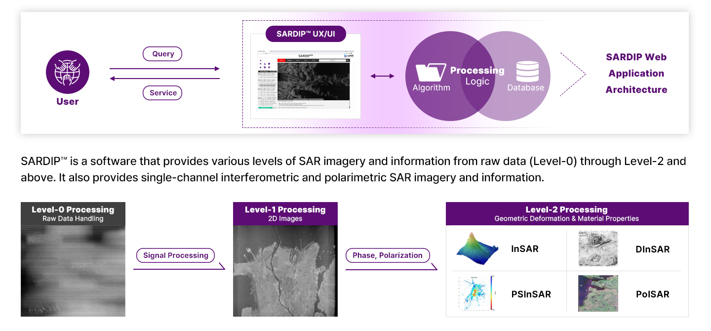
SARDIP™ is a SAR signal and image processing software developed by Lumir and is a cloud-based computing software on a Web service platform with the ability to process data from inhouse SAR satellites (LumirSat-X) and other SAR satellites. By using cloud computing, we can process a large amount of data at the optimal time, generate SAR images, and provide the images to users. Users can search and download image and information through the web.
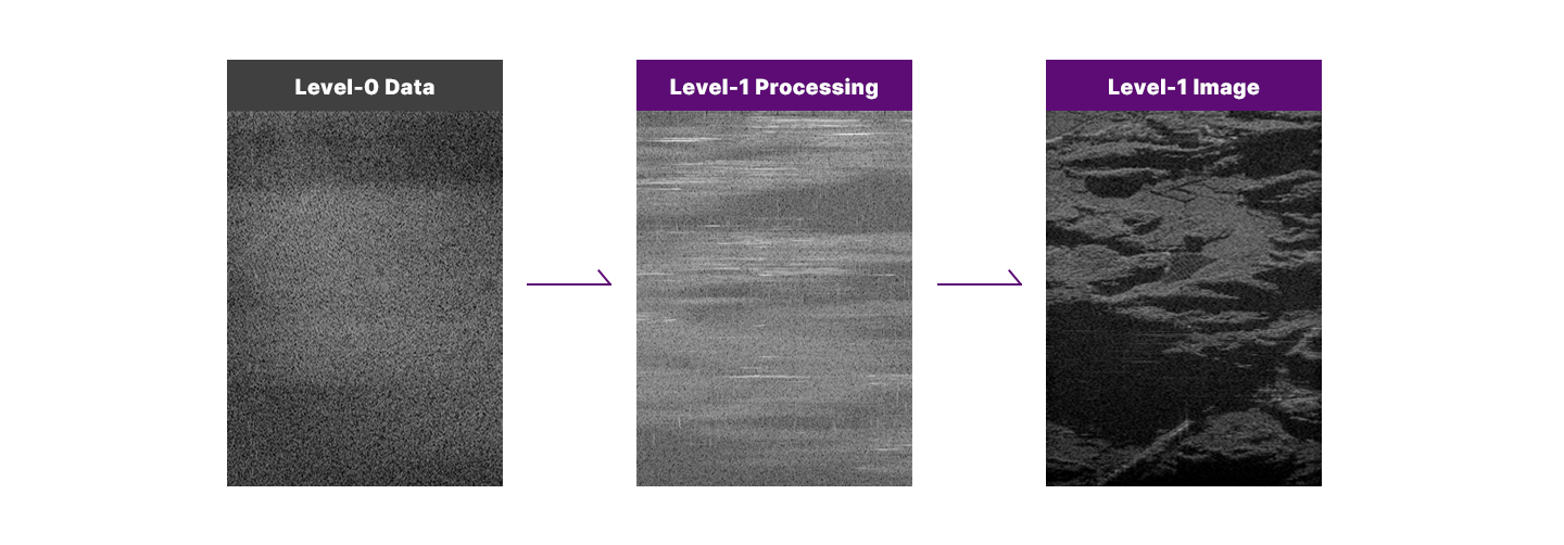
SARDIP™ Level-1 Processor: SAR Image Formation
The Level-1 processor processes Level-0 data (raw data) to generate Level-1 images with calibration and correction so that users can use the images. SARDIP™ uses several SAR image formation algorithms for various operating modes, including Stripmap, Wide Swath, Spotlight, Sliding-spotlight, and High Resolution Wide Swath (HRWS). By using distributed computing, multicore processing, and GPU acceleration, we can improve processing speed. The Level-1 processor implements algorithms appropriate for each operating mode, as follows:
ㆍRange Doppler Algorithm (RDA): Stripmap Mode
ㆍChirp Scaling Algorithm (CSA): Stripmap Mode, Sliding-spotlight
ㆍOmega-k Algorithm: Spotlight Mode
ㆍSPECAN: Wide Swath Mode
ㆍMIMOSAR Algorithm: High Resolution Wide Swath Mode
ㆍMotion Compensation & Autofocus (Especially for airborne SAR)
SARDIP™ Level-2 Processor: Generation of high-level imagery by using phase and polarization inform
The Level-2 processor generates images that can be used to extract various information by utilizing phase and polarization information contained in the Level-1 images. Level-2 imagery includes InSAR family which uses phase differences between two or more SAR images and PolSAR family which uses polarization. The InSAR images are used in topographic applications, while the PolSAR images are primarily used for surface feature extraction. The SARDIP™ Lelvel-2 processor provides the following imagery:
ㆍInterferometry SAR (InSAR) : to generate Digital Elevation Model (DEM)
ㆍDifferential InSAR (DInSAR): to measure the deformation of land and man-made objects
ㆍTime-Series InSAR (PSInSAR, DSInSAR, PSDSInSAR, ComSAR) : to measure deformation over months or years by using many SAR images acquired over time.
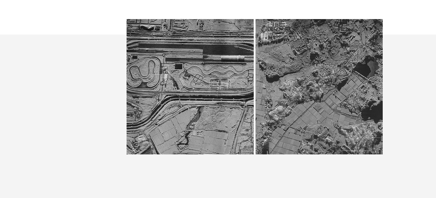
ㆍPolarimetric SAR (PolSAR) : to classify land surface characteristics
ㆍPolarimetric Interferometry SAR (PolInSAR) : to generate image with 3D location information + polarimetric information
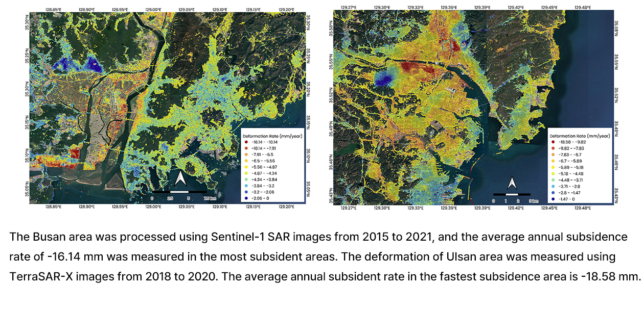
InSAR Applications 1 - Land deformation measurement
Lumir is developing a technology to measure surface deformation using the Interferometric SAR (InSAR) technique. We are developing LDMTTM (Land Deformation Monitoring Tool), which is part of SARDIPTM. Persistant Scatter InSAR (PS-InSAR) technique is implemented in LDMTTM to measure land deformation, especilly for man-made areas such as cities. The following image shows the speed of deformation in Busan (left) and Ulsan (right) measured by LDMTTM. Generally, subsident areas are considered dangerous, so those areas are shown in red color.
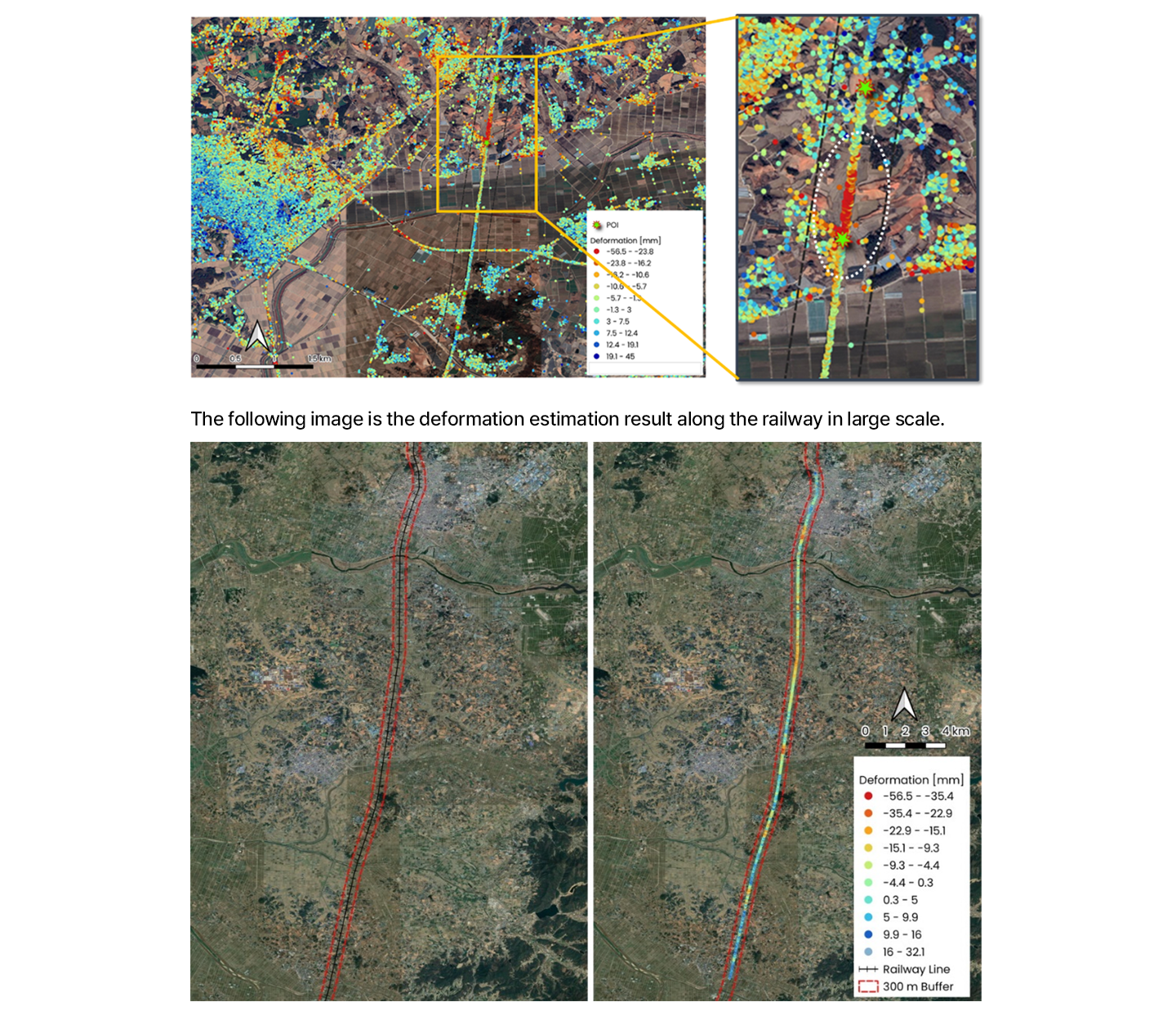
InSAR Applications 2 - Detecting deformation of man-made structure
The time-series InSAR analysis technique can measure the deformation of structures such as roads and railways. The figure below shows that the road/railway structure deformation processing TerraSAR-X images with the SARDIP™ LDMT, and the area marked with the white dotted line on the right shows relatively high subsidence compared to other locations.
Customized solutions
SARDIP™ provides a variety of customized solutions upon user requirements.
ㆍExtraction of earth surface features ? measuring soil moisture, agriculture monitoring
ㆍDisaster monitoring and assessment ? flood, Earthquake, land slide
ㆍSurveillance & Reconnaissance ? target detection, high resolution image acquisition
Specification
SARDIP™ Standard Input/Output
ㆍHDF5 Format